
Records That Describe Issaquah Neighbors
No single public source names every person on an Issaquah block. Build the view in layers. Map geometry identifies parcels. Property summaries identify taxpayers and site facts. Election records use controlled access, and association pages describe communities rather than publishing a complete resident roll.
| Official or local source | What it can show about the block | Access channel |
|---|---|---|
| King County Parcel Viewer | Adjacent parcels, addresses, jurisdiction, taxpayer summary, map layers | Free public map and reports |
| eReal Property | Parcel, taxpayer, site address, legal and building facts | Free property search |
| VoteWA and voter extract | One authenticated registration or authorized address/precinct fields | Sign-in or approved file request |
| City neighborhood pages | Named areas, programs, association context | Public pages; group contacts vary |
| Polk and local newspapers | Past names and households on a street or block | PSRA, museum, library |
An owner or taxpayer may not occupy the parcel. A permit applicant or association name also does not establish residence. State the precise connection that each record supports.
Map a Block Around Issaquah Neighbors
The King County Parcel Viewer can start from an address, parcel number, condo name, or intersection. It offers point, line, polygon, and freehand selection tools. A selected set can be expanded with a buffer measured in feet, then reviewed in a table of parcel numbers and addresses.
- Search the known address and confirm the displayed jurisdiction.
- Turn on parcel, parcel-number, address-point, and zoning layers as needed.
- Select only the adjacent parcels, or set and record a clear buffer distance.
- Export the parcel and address rows, then open each public property summary separately.
- Save the map date and layer names because GIS data and displays change.
For a full named-street chain rather than the immediate block, move to the Issaquah street directory.
Read Issaquah Neighbor Parcels With Care
The Parcel Viewer summary can display present use, property name, jurisdiction, taxpayer name, address, appraised value, lot area, levy code, units, and buildings. Property Report and Districts Report add context. The map also warns that lot lines are approximate, not legal boundaries.
The official Parcel Viewer information page leads to the same county mapping system shown here:
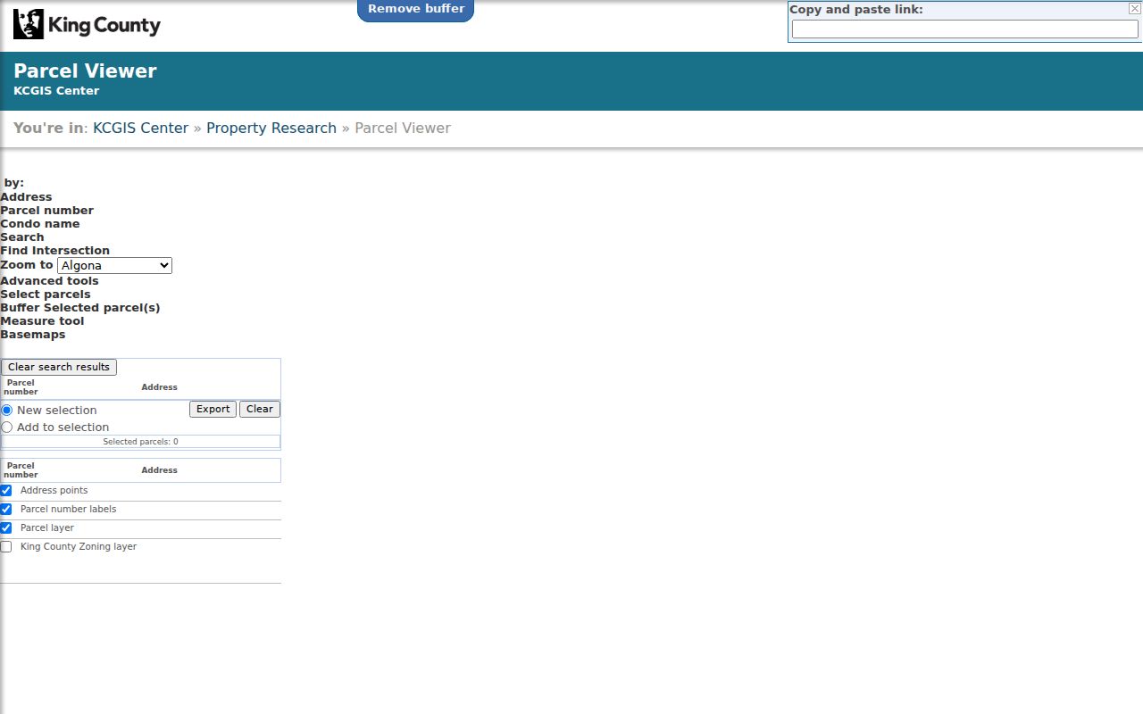
Use the taxpayer field exactly as labeled. It may name a person, estate, trust, or entity. The research did not establish one universal public owner-occupancy flag for every Issaquah parcel, and a tax mailing field can differ from the site address. Do not turn those gaps into guesses about who lives next door.
Label How Issaquah Neighbors Are Connected
“Neighbor” can describe several relationships, and mixing them produces bad results. An adjacent parcel shares a line or corner. A street neighbor sits on the same named segment. A subdivision or plat neighbor shares recorded land geography. A community or association neighbor is tied to a named development. A city neighborhood is a planning and engagement area. A ZIP or precinct is broader still.
| Relationship label | Evidence to save | What it does not prove |
|---|---|---|
| Adjacent parcel | Map selection, parcel number, date | That the taxpayers know each other |
| Same street segment | Address points and intersection limits | Shared subdivision or city |
| Same plat or association | Legal description or official community page | Public membership or occupancy |
| Same neighborhood | City neighborhood layer or page | Exact block proximity |
| Same ZIP or precinct | Postal or election map | Municipal boundary or adjacency |
Keep the chosen label beside every row in the notes. That one step prevents a map radius from becoming a false claim about a household.
Find Issaquah Neighbors by Local Area Name
The City of Issaquah neighborhood page names Central Issaquah, Issaquah Highlands, Issaquah Valley, Montreux, Newport, North Issaquah, Olde Town, Providence Point, South Lake Sammamish, Squak Mountain, Sycamore, and Talus. These names can be better search terms than a ZIP because community pages, planning files, permits, and news may use the local area name.
At the city edge, pair the neighborhood with parcel jurisdiction. South Lake Sammamish includes Greenwood Point, Lake West, Lindley Shore, Meadowbrook Point, Meerwood, Sammamish Beach Club, Sammamish Bluffs, South Cove, Timberlake Lane, and Weatherwood in the cited city design material. The area annexed to Issaquah in 2006, so earlier records may use county wording. Klahanie later annexed to Sammamish in 2016. A current postal label cannot replace those dates.
Issaquah Neighbor and Association Contacts
Association and community names help define a subdivision or shared program, but the research did not locate a complete public household roster. Use an official community page or the group's own public contact to ask about events and participation. Do not infer membership from a nearby address.
| Issaquah area | Named association or community context | Best public route |
|---|---|---|
| North Issaquah | Overdale Park, Rivenwood, University House, condo and townhome HOAs | City neighborhood page and the named group's public contact |
| Squak Mountain | Inneswood, Kelkari, Morgan's Ridge, The Woods | City neighborhood page and association site if published |
| Talus | Talus Residential Association in a 630-acre master-planned community | Association's public information and city planning records |
| South Lake Sammamish | South Cove, Greenwood Point, Timberlake Lane and other community names | City engagement and planning pages |
Contact records are for joining civic life or confirming public program details. They are not permission to request or publish a private member directory.
Map Your Neighborhood Without Exposing Issaquah Neighbors
Issaquah's Map Your Neighborhood program organizes groups of 15 to 25 households for a 90-minute training, a neighborhood map, and an emergency resource plan. It suggests noting gas or propane meters and households that may need help after a disaster. The city also lists Block Watch, National Night Out, neighborhood walks and block parties among its engagement programs.
This is a useful human reason to know the block, and it comes with a firm limit. The household map is a sensitive emergency resource, not a public neighbors directory. Share it only within the program's intended circle and follow current city guidance. Public pages can show how to organize, but they do not make the resulting names, needs, access details, or utility notes open for reuse.
Voter Records Do Not Open an Issaquah Block
VoteWA cannot browse all voters on a street. It authenticates one registered voter with first name, last name, and date of birth. Washington's separate voter-database extract can include permitted name, address, jurisdiction, precinct, birth year, registration, and voting-history fields, but it requires a request agreement. RCW 29A.08.720 and .740 restrict commercial solicitation and misuse, and protected Address Confidentiality Program records are withheld.
For a block-level civic question, use the King County Elections contact page to ask the public-records officer or GIS staff about lawful data and boundary maps. The Issaquah election map supplies precinct context but no names. Washington does not register voters by party preference, and participation history never shows a ballot choice. A precinct is useful geography; it should not be treated as a door-by-door directory.
Official Records and Commercial Neighbor Results
Official sources are narrow and accountable to a custodian. Parcel Viewer shows mapped property facts. The Assessor explains its tax roll. Elections controls voter access. A city neighborhood page describes local programs. Each source gives a date, field set, and correction route.
Official records
Best for a specific parcel, jurisdiction, filing, precinct, or dated public fact. They may omit protected data and usually do not prove occupancy.
Commercial compiled results
May merge public filings, old marketing data, and self-reported facts. Results can be stale, combined across people, or hard to correct. Treat them only as leads and cite the custodian record.
For Issaquah neighbors, map a defined block and verify only the facts needed for a lawful personal purpose. More fields do not make a compiled profile more reliable. A short, well-sourced map note is safer and more useful than a broad list of uncertain names.
Privacy Limits When Finding Issaquah Neighbors
Public records do not index every occupant, family member, or visitor. Utility customer data, school attendance lists, delivery records, and private association rosters were not found as open Issaquah people-search systems. Courts redact personal identifiers, voter files have use rules, and Washington's Address Confidentiality Program protects actual locations for eligible people under RCW 40.24.060-.070.
If a parcel or official record is wrong, send the correction to its custodian. Do not fill gaps with social guesses, publish a sensitive community map, or try to connect a substitute address to a physical home. Respect signs that a person does not want contact.
Lawful use. Learn about Issaquah neighbors for civic participation, emergency planning, reconnecting, or personal safety. RCW 9A.46.110 prohibits stalking conduct, and a public record never permits tracking, threats, or harassment.